 This is a day-hike articleThe Tombstones have been calling me back since the first time I met them, and I've answered as best I could but never quite well enough in my prior attempts, arriving with too little time, or in the wrong season, or with a plan that assumed the weather would cooperate. This trip is my attempt to answer properly. A month here, and as many named mountains as I can reach on foot, up every ridge that's actually accessible. Not all of them are on the correct side of the river from the highway, sadly, but there are a good four or five ridges that are, and I intend to walk them.
The first of these would be the ridge running up to Mount Robert Henderson, named for the man who inadvertently started the Klondike Gold Rush by telling Carmack to come and mine there after he'd prospected gold himself, and to Chester Henderson a little closer to the edge of the range, named after Robert's grandson. The two of them together I'd taken to calling the Hendersons, which I suspect nobody else does, especially after finding no shoe prints anywhere up and down this ridge, and therefore none who would be so intimate with these mountains as to refer to them in this way. But, beyond them the long curving ridge carries on, dropping and re-ascending, to Mount Big Alex.
I'd spent that morning in the truck on calls, which is a sentence a lot of people don't quite believe when I say it out loud, but the Starlink dish works about as well parked in the Tombstones as it does anywhere in Victoria, and my job doesn't especially care where I'm sitting when I do it. I'm employed by PHSA and I serve all four health authorities in the lower mainland on any given day, PHSA itself along with Vancouver Coastal, Providence Health, and Fraser Health, with a mix of projects across them. Officially I have over 20 on the go, and 8 to 12 of them will surface in any given week. As a solutions architect on contract that means my hours are flexible in the sense that I can move them around or start and stop based on demand, not in the sense that I can skip them or rudely ignore deadlines. Around the job there's mentoring once or twice a week, a municipal campaign I'm managing for my best friend, and volunteer commitments with organizations like the Vancouver Island section of the Alpine Club of Canada. By 2pm I'd closed the last meeting, shut the laptop and filled 4 litres of water, of which I'd drink a record minimal 1.8L in the end. The truck was already parked exactly where I'd leave it off the road where moose prints were cast in the mud, I had parked it there the night before, so there was nothing left to do but start walking, which is how a hike that wanted an early start got underway just before 3pm. It's also how a hike that wanted a tent got a day pack, since I'd changed my mind about backpacking it the night before over pack weight and the prospect of a wet night, and told my mother I'd be back by 10pm.
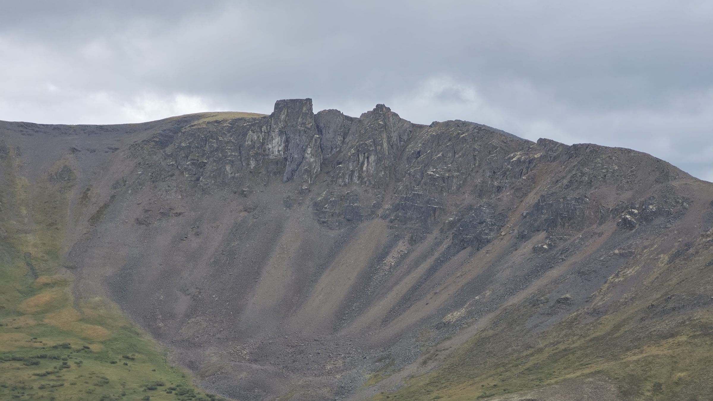
I began my journey with mild trepidation, seeing clearly from my truck the jagged and simultaneously loose terrain on the shoulder of the mountain I would summit. My vantage point on the road was of the side profile, and in order to surmount this alpine ridge to the three summits I wished to step foot upon, I would need to reach the ridge's edge, where from afar it appeared a much more graceful and dignified slope than it did from the sides. It would be like any other ridge, I told myself, but without the troubles a forest path would present. Indeed, there was little that you could call a forest, and yet there was vegetation. From the road, having driven by the day prior, I knew that there was a break in the dwarven trees and the tall bushes. That break would open into a field of sorts, but not like any in the south or indeed in Europe that I knew of. These fields, in this park, are made of sedge piles, moss mounds, and lichen pads. Undoubtedly biologists would have different names for them, and it mattered little to me because my dim knowledge of the park's biology and herbology would not cause these fields to somehow become easier to traverse. I knew from a decade prior that such terrain would pose two serious challenges, because although these piles, mounds, and pads are all compressible and have the effect of forming a cloudy loam to walk upon, they're the furthest thing from uniform or broad that I can possibly imagine. They're narrow and steep rather than broad and stable, so each step risked spraining an ankle should I be none too careful.
What's good about this terrain is that it forms an incredibly rich tapestry of colour, and even on a cloudy day you can admire the whites and yellows and reds forming by the end of summer as the green begins to make way under the weight of the cold. The trouble with the piles is that you can't tell where a foot will end up until it's already there. The moss gives under the ball of the foot and then keeps giving, unevenly, so the heel settles an inch or two below the toe and a few degrees off whatever axis an ankle is built for, and the correction happens somewhere well below thinking, the calf firing, the ankle rolling back into line, and an arm swinging out to buy a fraction of a second's balance. Once is nothing. But you must understand, I did it a few thousand times between the road and the boulders, and by the time I reached stone I could feel it as a dull heat running from the arch of each foot up through the shin and into the hip. The twisting and awkward steps, though compacted and easy on my knees, proved horrible to my ankles, to the muscles in my feet down to my toes, and even to my hips.
The additional threat that these fields would pose after this hike was thankfully absent despite the relatively wet summer, which is the frigid puddles that innocently and calmly pool between each of the raised attributes of the vegetated fields. On my last wet hike through this park, many kilometres to the north and many years prior, I'd experienced at the end of the day a misstep that led to my entire foot and ankle being engulfed in ice cold water. Mercifully, despite the discomfort posed by the vegetation today, I realized I needn't in fact step on the tallest and thus narrowest piles, and could step between them far more leisurely and without fear of ending the hike early. However, this too proved a hazard, though a minor one, as my feet would sometimes find themselves captive of the surrounding vegetation and I'd be pulled back only to narrowly escape tripping.
After getting the hang of this comfortable yet awkward terrain, I failed to realize that I hadn't obeyed my aerial scouting with maps and advanced tooling, and so missed the convenient second gap in a further row of trees. Instead, I managed to make a far around effort in order to approach the mountain via the ridge as though aligning to it in parallel. The mistake became evident as walking through knee high shrubs grew to waist and then chest height bushes, and soon I was the dwarf among dwarf willows. As these were all thin branched plants, I was able to push past them, but my unease of being caught face to face with a grizzly bear at any moment gave me the inspiration, or the anxious retort, to use my phone for music. After all, this would be a day hike and my bear bell would likely be too faint and infrequent in such dense brush for any animal to be alerted of my presence any sooner than I would be to its presence. Some may consider this folly, as they may wish to have their wits about them, without distraction, and without unnecessary noise blocking out any signs of distant brush breaking. But to them I say that most hikers travel in pairs and attempt to speak loudly, easily distracted and indeed gratefully so while exerting their bodies, with conversations that whittle the time and effort away. Others would agree, but in a cynical way, stating that bear bells are simply dinner bells to grizzlies.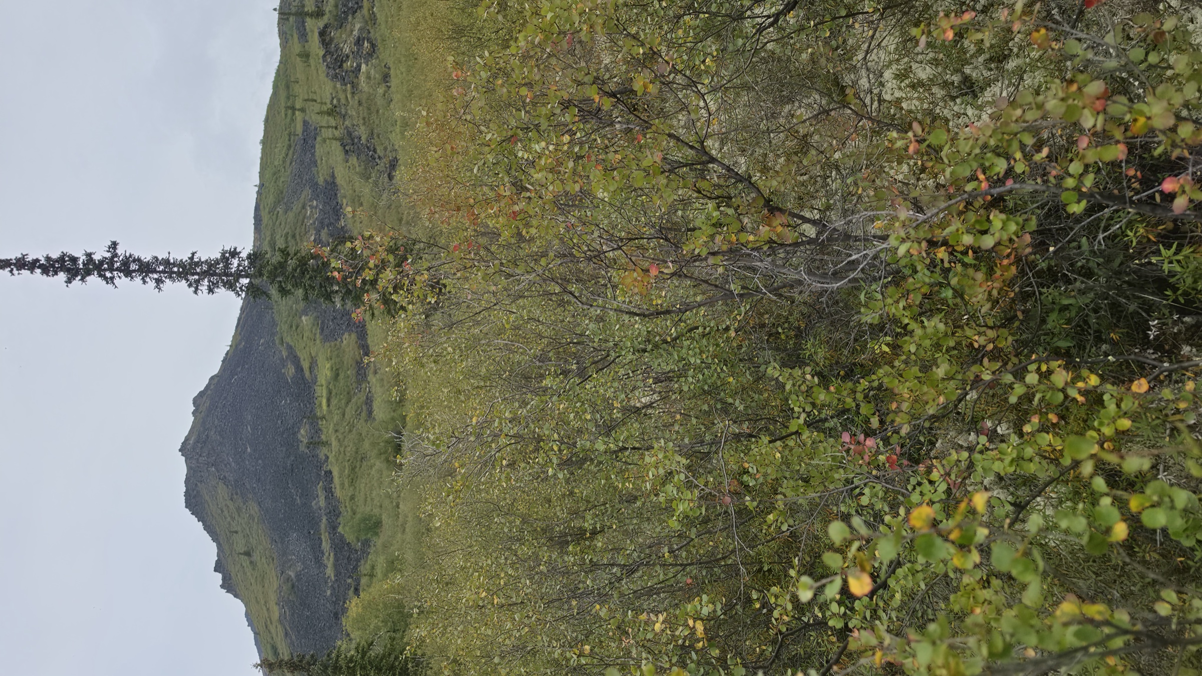
The dwarf willows and the low bushes gave up their oils as I pushed through them, so a hike I'd expected to smell of wet rock and moss smelled instead like someone had been crushing herbs into it all afternoon, and it followed me for hours afterward because most of it had ended up on my Patagonia hiking pants. The bushes were carrying aphids by the dozen, and I stopped longer than I should have, because they were all glowing bright green and yellow, a few of them were white, and a few more were even a cyan blue, something I've never seen on an insect in my life. Naturally, the blue ones are the ones I failed to photograph, which I only worked out much later while labelling the photos, so you'll have to take the white and green ones as evidence of my honesty and the blue ones on faith. Aside from the mosquitoes, the midges, and one caterpillar I'd meet a good deal higher up, they'd turn out to be the only living "animal" I saw between the road and the spires, which is a strange thing to be able to say about a day spent worrying about grizzlies and spotting hoof prints from various ungulates, including moose tracks, caribou prints, and little itty goat trails with their tread along them. Plenty of animal scat was seen throughout the day, hardly any I could identify though, because most of it was so small and must have come from goats or more likely rodents.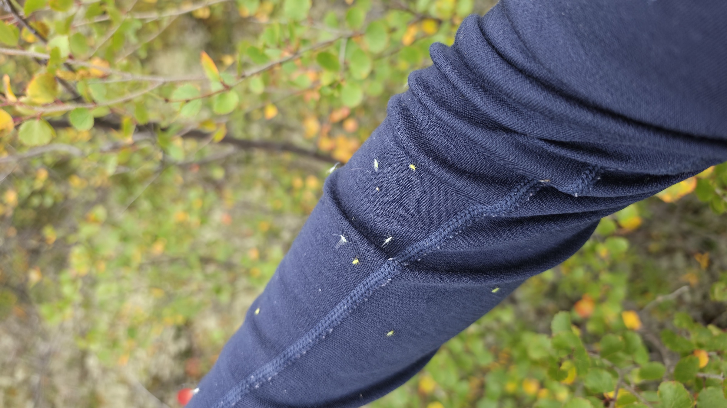
The mosquitoes and midges, who both normally act weakly around 12°C, were perhaps startled or enraged by my bushwhacking and field crossing, for they'd formed a large swarm around me that only further thickets could seemingly interrupt. Fortunately, my beautiful black felt hiking hat was by now in great need of washing and I think took much of their attention as it was not only odorous, but also quite warm. Still, occasionally they would try to land on my arms and attack through my sleeves. I knew from my couple of nights at the Alkan Air base in Mayo that the mosquitoes up here were quite different from whatever my naive notions were on prior trips. If you flicked a mosquito while its proboscis, the mouth needle thingy, was in your arm, the mosquito's body would be flung away and its proboscis and eye parts would be comically or horrifically stuck in your arm still. You could feel them penetrate your skin far more effectively than their southern cousins, and despite being made of stronger stuff, they were slightly smaller, which gives them quite a character write up for something you can find basically across the planet. While I didn't worry about the challenge the boulders would pose for this next leg of the hike, or especially for the return journey, I also didn't labour upon them too resentfully at first, because to flee the mosquitoes for higher ground where the wind was much stronger would be a relief my working muscles could afford to pay up. It wasn't just the wind, either, as these insects simply cannot endure after a certain temperature and they were long gone for the rest of the hike thanks to the wonderful cold.
I should say plainly that the cold was, for most of the way up, the best thing about the day. I run hot, always have, and on the Island a climb like this in August would've had me soaked within the first hour and rationing water by the second. Here I was working up a 10% to 40% grade through wet brush and staying comfortable, dry under my layers, putting in real effort without the usual penalty for it. The weather itself was still a disappointment, and not only on the day of the hike, since the week before had been cold and grey and the week after would be no better, which is a hard thing to swallow when you've driven several thousand kilometres to get somewhere. On the climb, though, I'd have taken that trade every time.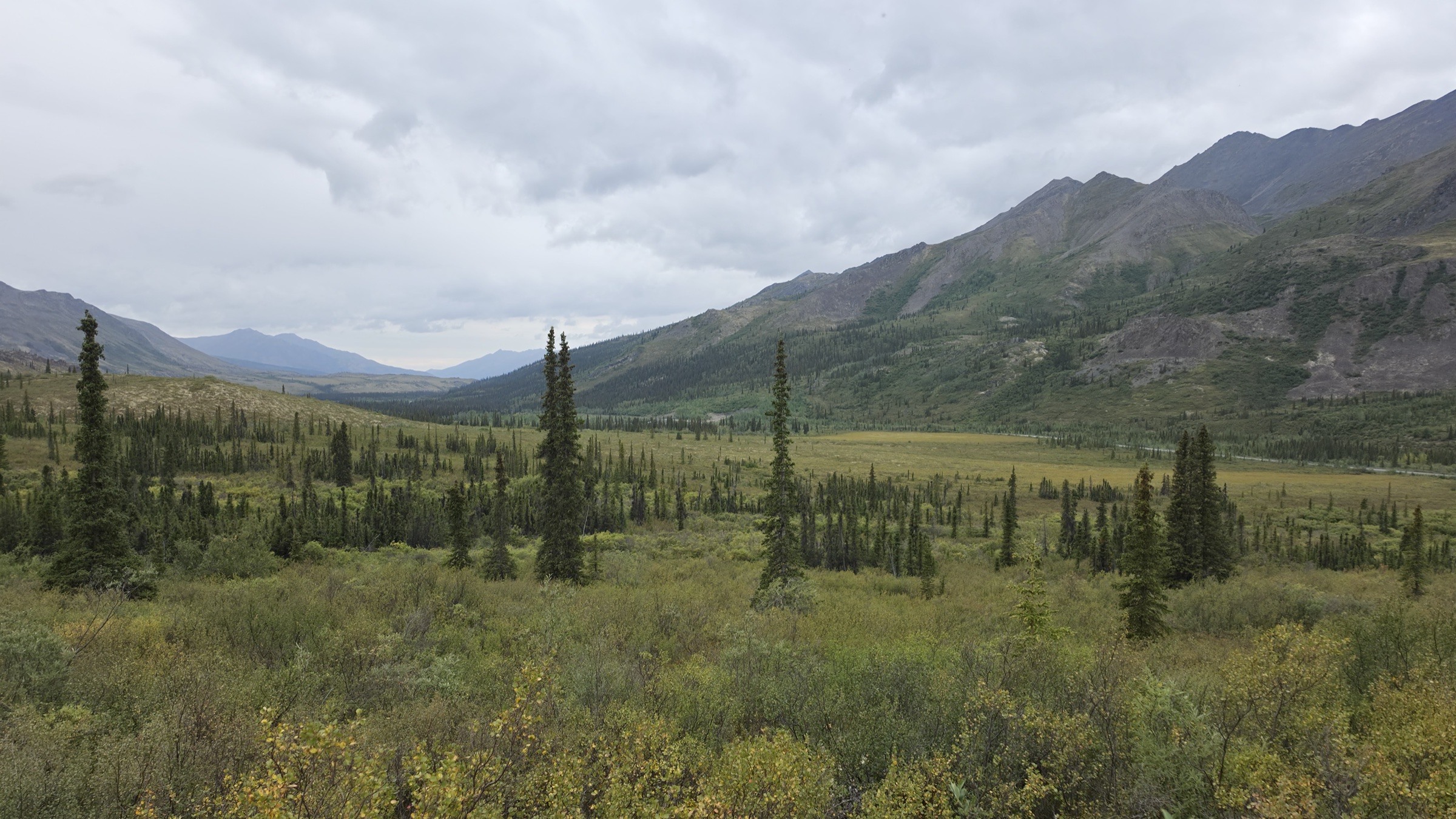
After less than half an hour, I exited the treeline and found myself still in high brush, only now with the added challenge of boulders as small as bicycle tires in diameter and as large as bicycles themselves. Pushing through vegetation on more than a 20% grade proved rather exhausting and perilous as now the mossy, lichen painted earth became stone, which in all respects can be considered more slippery. As I continued to climb, however, I began to miss the untrustworthy surfaces, as now the boulders were no longer held by the roots of yellow-green plants, and would teeter or shift, sometimes rather suddenly as though disposed to show how wild they were in this country. My weight is not impressive by any means, but sometimes even a hand pulling on a boulder would cause it to lean towards me, and the smaller of them would actually attempt to grind a little as they shifted menacingly down the mountain. Fortunately, none fell far or indeed on me, yet as I rose still further up, finally gaining a view of the valley below, I'd find the boulders possessed still more features to startle me.
It was somewhere in the middle of all that stone that I found the caterpillar, dark and slightly green and rather furry, sitting perfectly still on a rock he matched almost exactly. I very nearly put a hand down on him. He looked entirely innocent about the whole thing, as though the boulder field were a reasonable place to be and I were the one who required explaining, and I have to admit that he blends into my memory of the day about as well as he blended into the rock.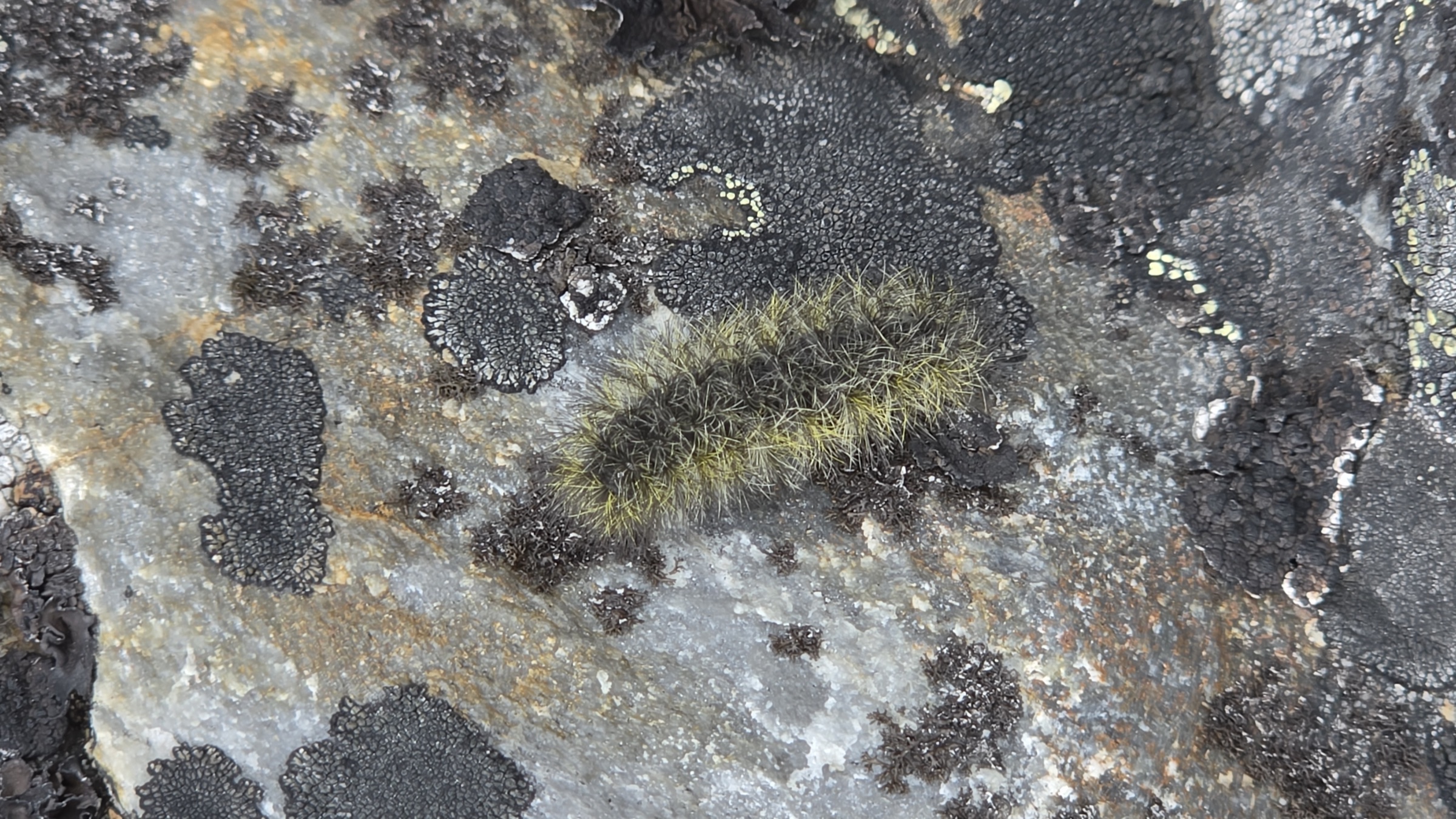
By this point I was starting to no longer feel as though I was at the foot of giants, such as Fold Mountain and Mount Cairns on the other side of the highway overseeing the beaver lodges, nor the remarkable Outrider Mountain which marked the beginning of a parallel ridge who came to meet my own at Mount Big Alex, and all of which was perpendicular to the highway, with Big Alex being as far from the highway as the ridges would allow. Along Outrider Mountain's ridge to Mt. Big Alex, there was a continuous rock wall with an impeccable flat top, colour bands, and the eroded scree all below and along it. But I hadn't yet been able to peer into the u-shaped valley between myself on Chester Henderson's ridge and the ridge joining up with Mount Big Alex. I knew the valley was clearly glacial, but from this vantage point all I could do was admire Outrider, not being very tall but being quite prominent, and the gorgeous folds of vegetation along the valley bottom and into the main valley where the highway tracks north to south. My northern view was still blocked, but I knew that between the northern view and the view of the valley leading between the Hendersons and Outrider, I'd be in for a treat, no matter the light level.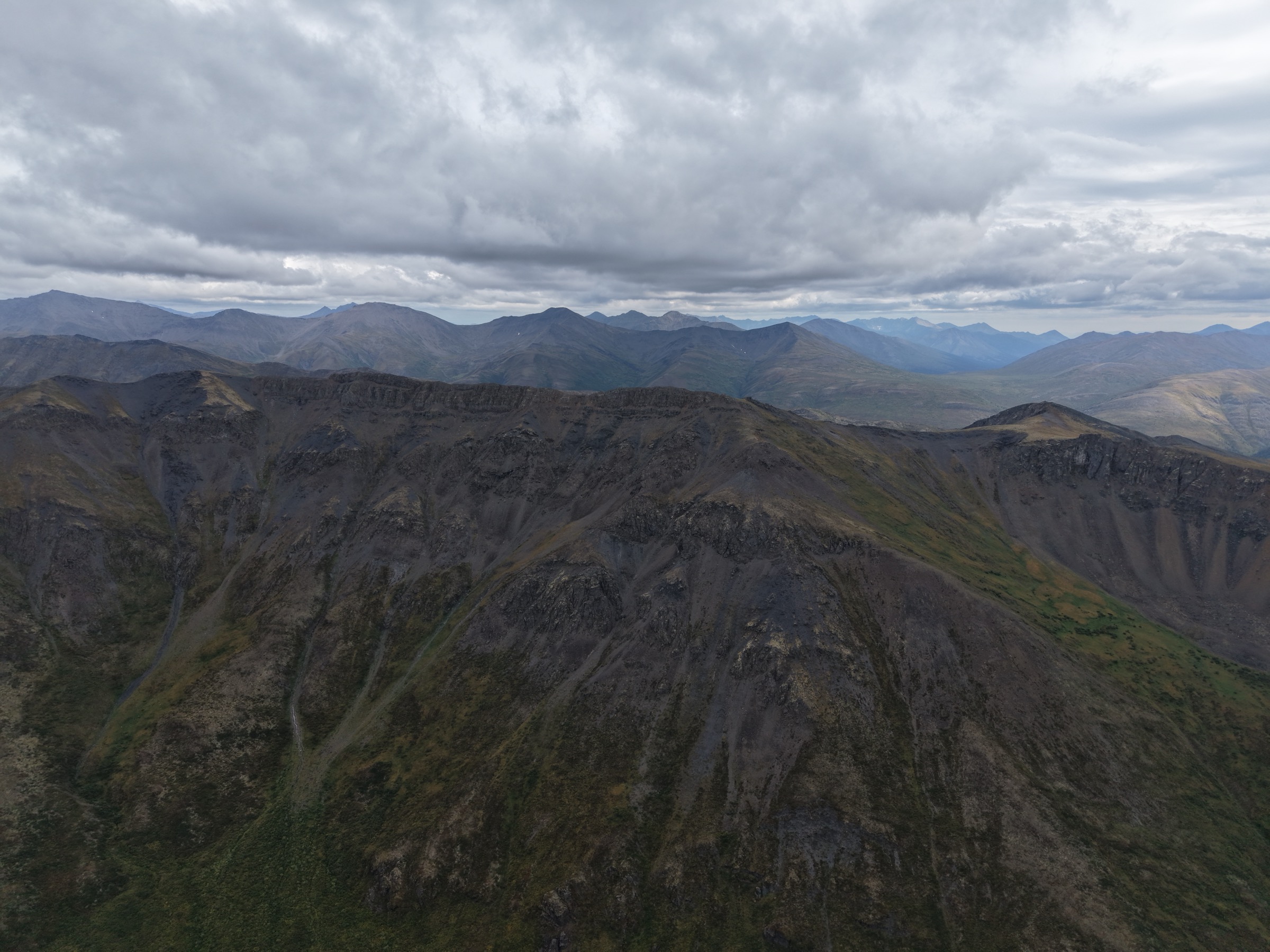
It felt odd that there were no animals, or that I couldn't see my truck from a few hundred metres above, but I could spot the rather impressive beaver lodges and ponds. I'd been reading the boulders three moves ahead for the better part of an hour, and then I looked left and lost several minutes to those ponds without intentionally looking at all. These were not ponds simply because they were adjacent to one another, they were in fact far more interesting than any I'd previously seen, with feats of engineering I truly did not expect from an animal I already admired for its engineering capacity. What made them so impressive was that the beavers had actually created elevated ponds adjacent to each other, with mud and organic materials forming thin long dams immediately adjacent to other ponds. The sight shared the effect of photos I could recall of rice fields in China, those upon the slopes of steep terrain. The effect was less pronounced from so many kilometres away, and yet there it was through the dim light cast by the iron grey clouds above me. At that point I couldn't tell their elevation differences being only a meter or less taller or shorter from one another, though they clearly bore a great deal of moisture for what has historically, over tens of thousands of years, been an arid region.
Clearly this region must have water in abundance because of the bountiful piles, mounds, and pads of water loving colonial organic life in the fields below, as well as the stunningly white lichens and rich green, surely it couldn't be, grasses and ferns?! Between the boulders, as far up as maybe 500 metres, I was continually surprised by plants so common where I live thousands of kilometres away, and even, as it had earlier turned out in my trip, mere hundreds of kilometres south in Atlin. My only thought was that at some point pikas must have foraged for these somewhere and brought them up gradually north to the slopes of mountains, and a sufficient quantity over the millennia became cultivated by them inadvertently near their warrens or burrows. Only in that moment did it dawn on me why in Harry Potter the antagonist Draco Malfoy was so apt for calling the Weasleys weasels. Because only a rodent would live in a burrow. Kidding aside, I think the most impressive feat for these plants is that life finds a way. Not to say that ferns and grasses or even sedges don't survive harsh winters or the low light of dense forests, but this landscape is dominated by far hardier vegetation for a reason. Winters this far north of Dawson City regularly maintain -30°C, and I should know, having quite literally frozen my eyelids shut on one such winter.
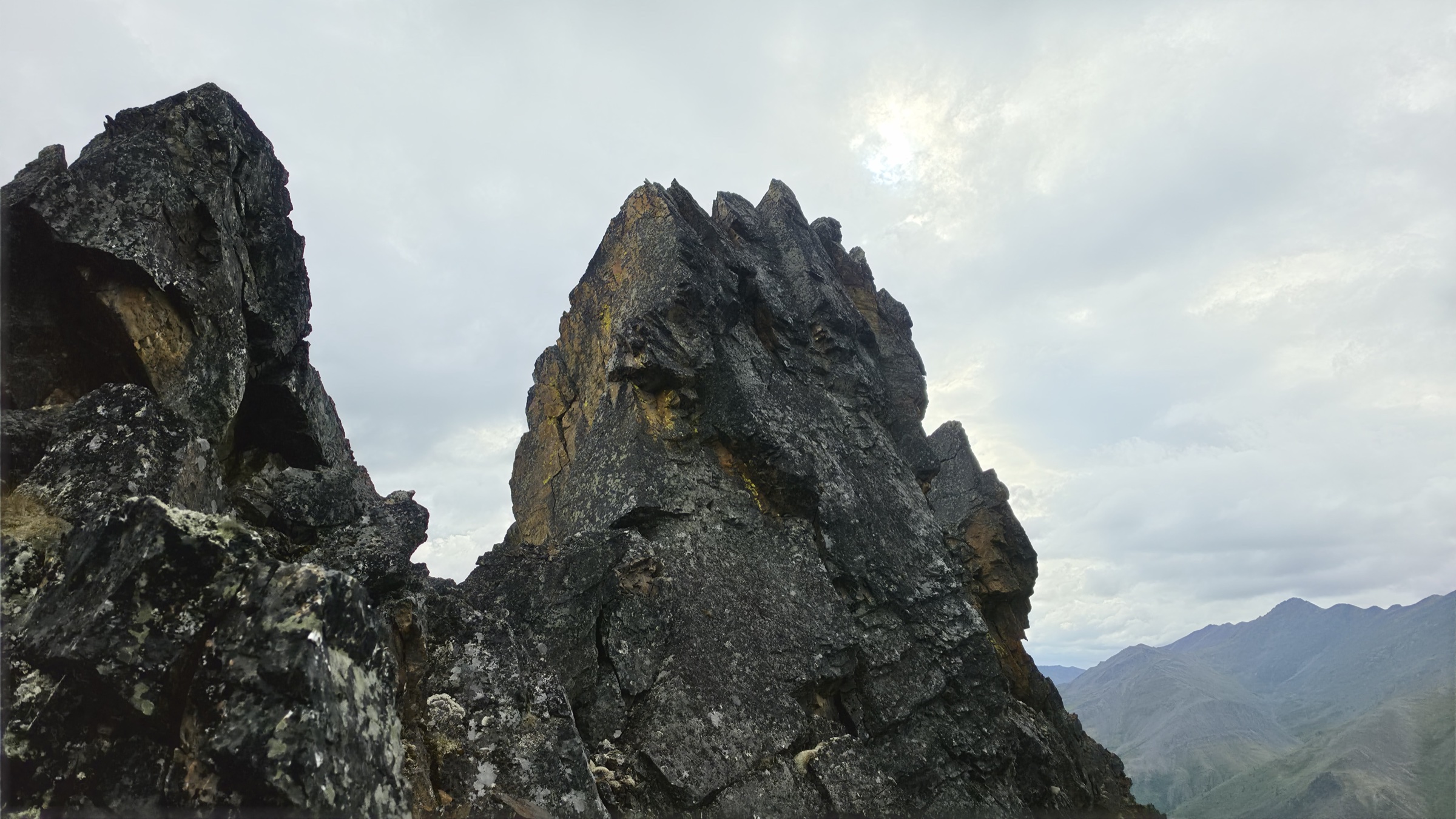
It felt as though the boulders would never end, until finally I reached what I knew to be far worse and yet still felt grateful for. The solid rock that formed the massive towers of, well, slate, which for me usually raises curiosity and admiration in my eyes and a grimace upon mouth. I was daunted by the sheer face, and so high up that I recognized little room for error being all on my own. The first tower proved to be the most solid, a firm hand hold wherever it was needed, and mostly two-wheel drive hiking rather than clambering allowed me to scale it. But I knew from the road that for each tower was a descent after it, and I knew that descent would lead me to scree. So before fully summiting what was quite meagre next to the actual summit, this sheer tower, I decided to shimmy around it about half way up and in this case definitely leverage my four-wheel drive. Upon rounding the thorny vine-like tower of shale, with its several trick ledges that ended in drops, I arrived at what was certainly not solid ground. It was a massive ridge of loose sediment made up of the fine particles of shale left over from the weakest of what once connected these four towers of rock. It was unsightly, and the destination across was just as uncomfortable to look at. For though they were impressive, the realization dawned that this was in fact about to be a rather daring feat to accomplish.
I was daunted to say the least, and the vertigo of seeing how steep each side of this narrow straight pile of sediment had evoked a bit of cowardice I wasn't expecting to boil inside of me. Despite hiking to the summits of many mountains, heights had never grown on me, and even flying in bush planes still gives me the heebie-jeebies from time to time. It took a significant summoning of will power and bravery to even consider the approach, the thought of turning back brought me shame, and I collected myself by stating that I hadn't come all this way to let fear overcome me. I'd travelled for thousands of kilometres and three months, and if I couldn't conquer my first hike due to nerves, I was not only a coward but a fool. My resolve hardened and I decided to press on.
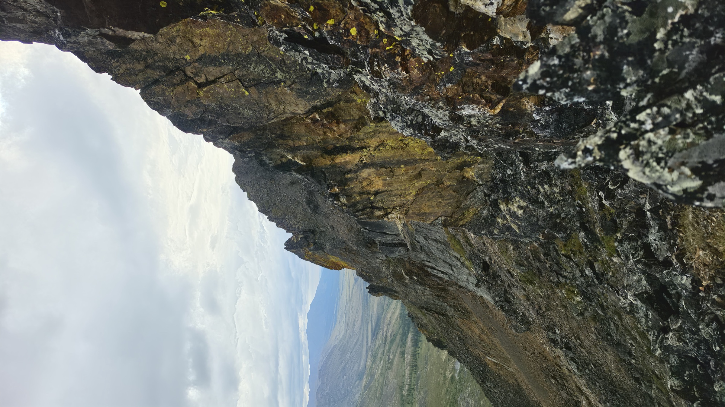
The question then became whether to walk on top or on one of the two sides of this loose sediment ridge. I chose to walk on top as it wasn't too daring, though I knew all too well from this vantage point and that of the spike that I'd be unwise to even so much as look left, for it was a long and steep drop, pile of loose shale or not, and I'd be descending in an uncontrolled slide with ill-fated consequences should I lose balance. Upon reaching the second spire, I was disappointed to find that it was much more aggressive and far less willing to hold itself together. Something caught my eye on this spire and later spires, which was the sighting of the most bright yellow growth I've ever seen in person. Although my phone camera undoubtedly adds saturation to the photo, as they all do, it actually fails to capture just how yellow this was. I say growth because I hesitate to call it lichen or mold, since it appears bubbly but thin as a lichen might, yet so bright that I could at once think of a slime mold. It grew in fabulous circular pads, which also reads to me more like a lichen, as slime molds tend to wander a bit more. Eventually I had to tear my eyes away from the initial ones and carry on, but fortunately they seemed to be in abundance and I was able to capture their extensive and expansive colonization quite well with my camera.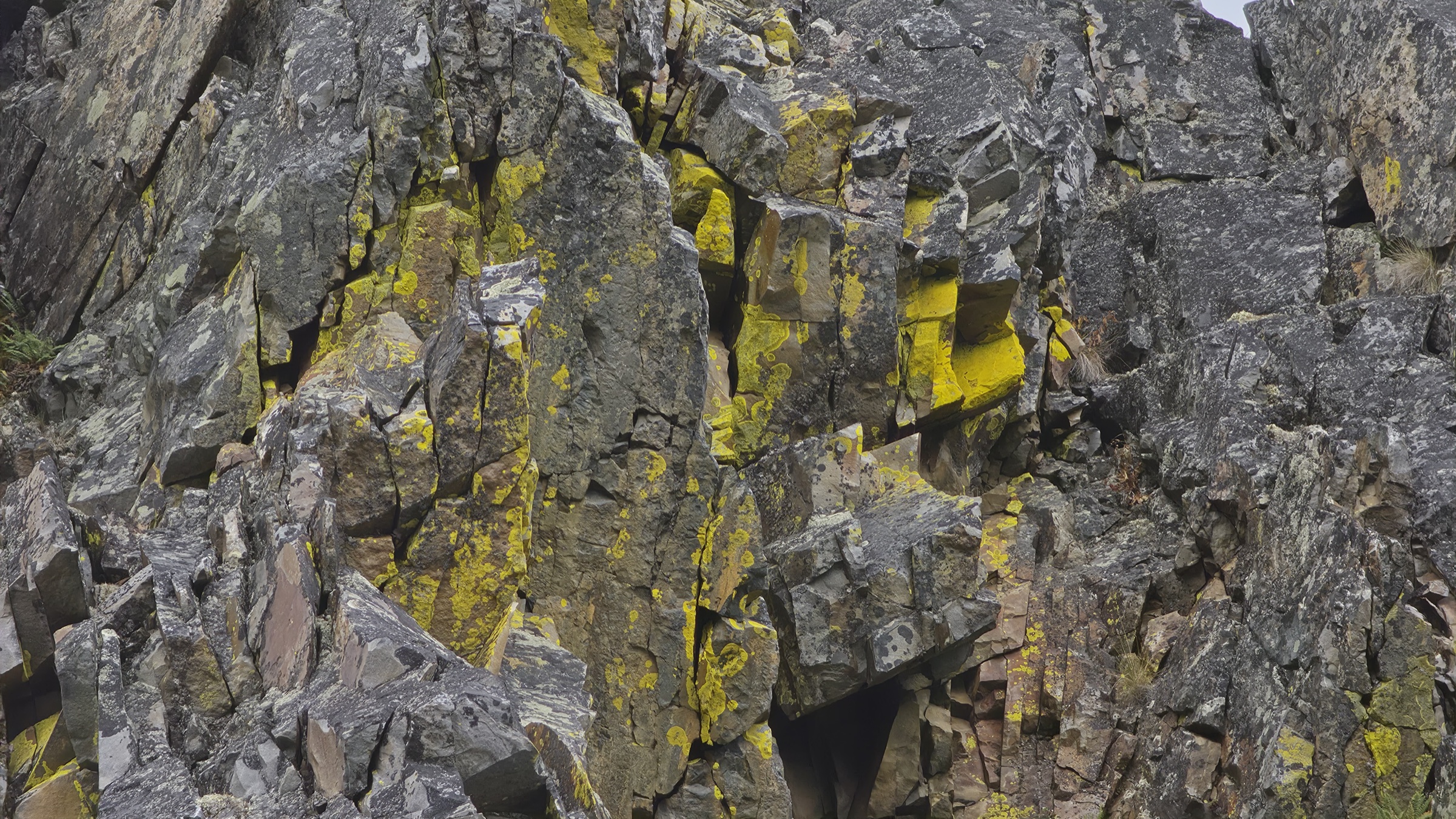
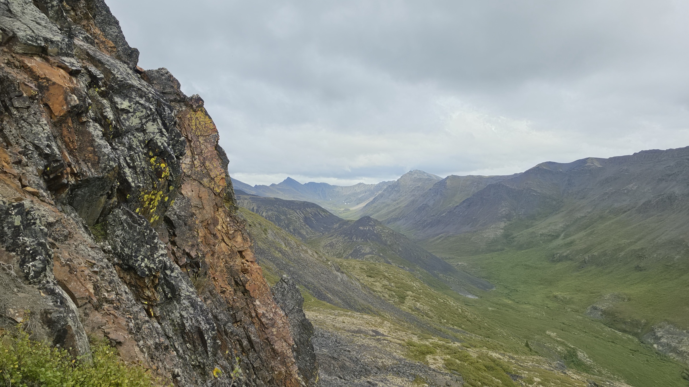
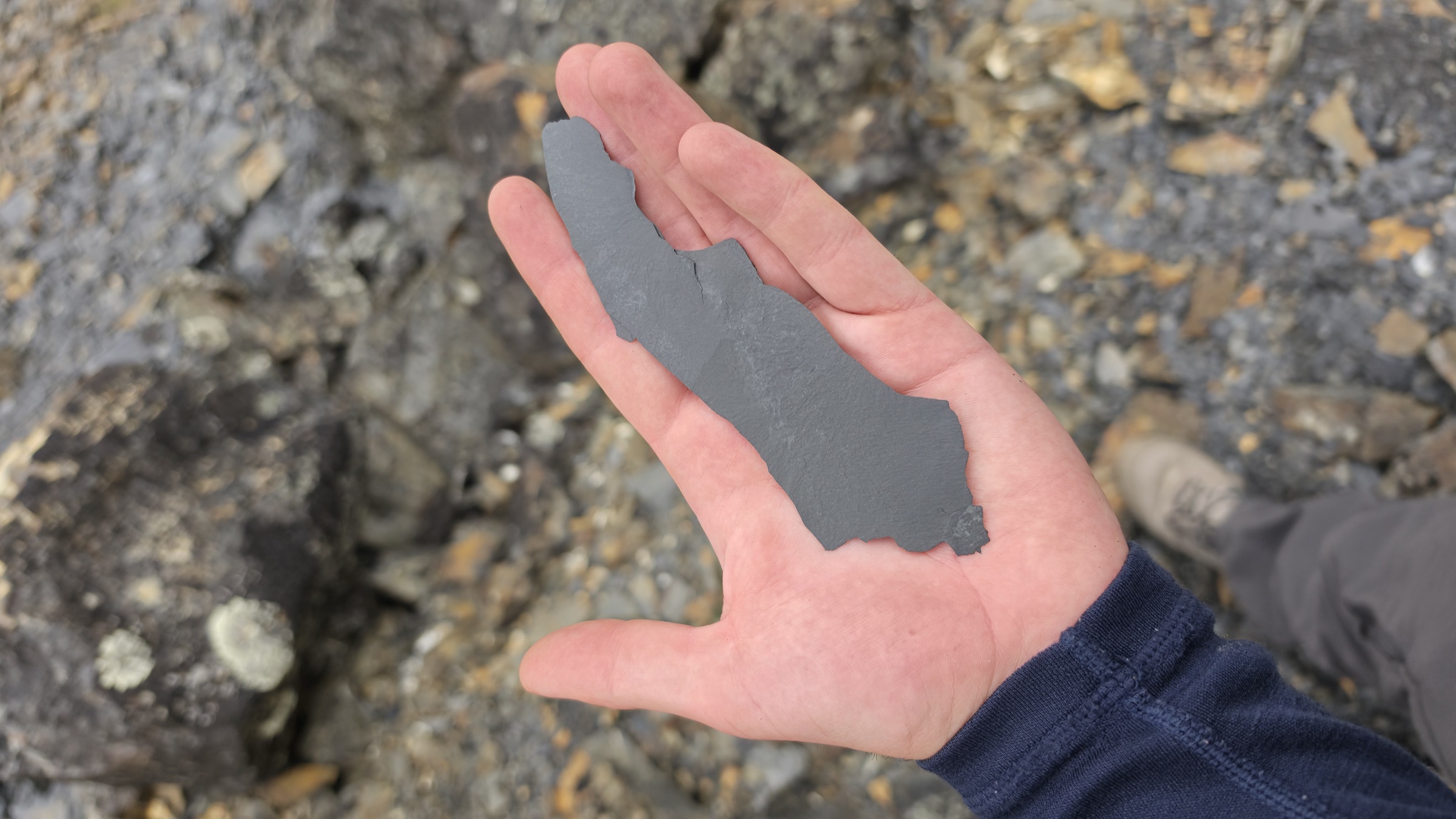
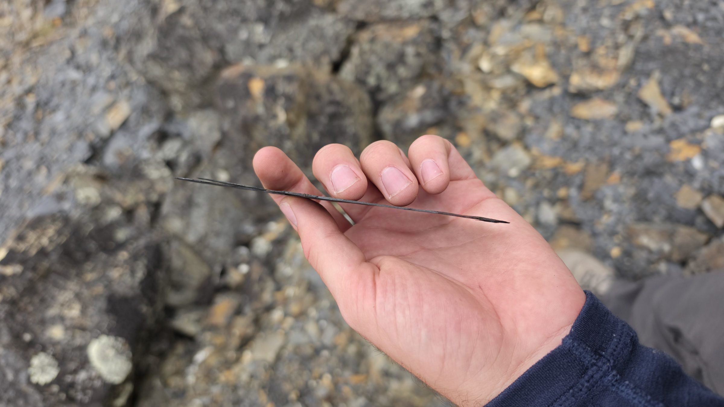
As I reached for hand holds, chunks of rock larger than basketballs would crumble and force me to right myself lest I follow them down a sandpaper edge with a 3 or 6 metre drop to what amounts to smashed concrete. No human would maintain all their bones intact should they be so unlucky as to fall. As these large rocks tore themselves away from the cliff face, they'd make an almighty crack down below before breaking like an egg, and as the dust would clear I could swear that I smelt gunpowder. Each time this would happen, I would scowl at the spire and curse before looking down. The sight and the smell made me nauseous, though that didn't seem to prevent how hard it was to peel my eyes away when it happened. But my luck hadn't yet run out, and I was swiftly met with another fine grained and shattered shale pile which formed an immense continuation of the ridge. This time I wasn't in a position to reach the top hump of the pile and would have to traverse it along the less steep side on my right, which sounds comforting until the realization that every step forced me to slide down and most of them threatened to topple me as the loose sediment gave way more than I would have liked it to. If you've ever walked up a steep sand dune, you can likely relate. The way up is exhausting, but there are rewards for the risk of following it down should you be in pursuit of descent.
The third spire was geologically fascinating, in so much as it presented me with intact layers of shale the size of which I'd never encountered previously. The spire was made of it, and I was impressed by this make-up even more than I was worried about it splintering, shattering, and crumbling under my weight and grasp. Every hand hold threatened to cut me several times along the same axis, and I was never very trusting of anything I touched. But finally, after another risky upwards traverse, where curses flew of their own accord as I struggled up the shattered glass and sand-like slope, and with my heart still pounding, I knew that the loose sediment was behind me and the remaining tower would lead me to stable ground, and so it did.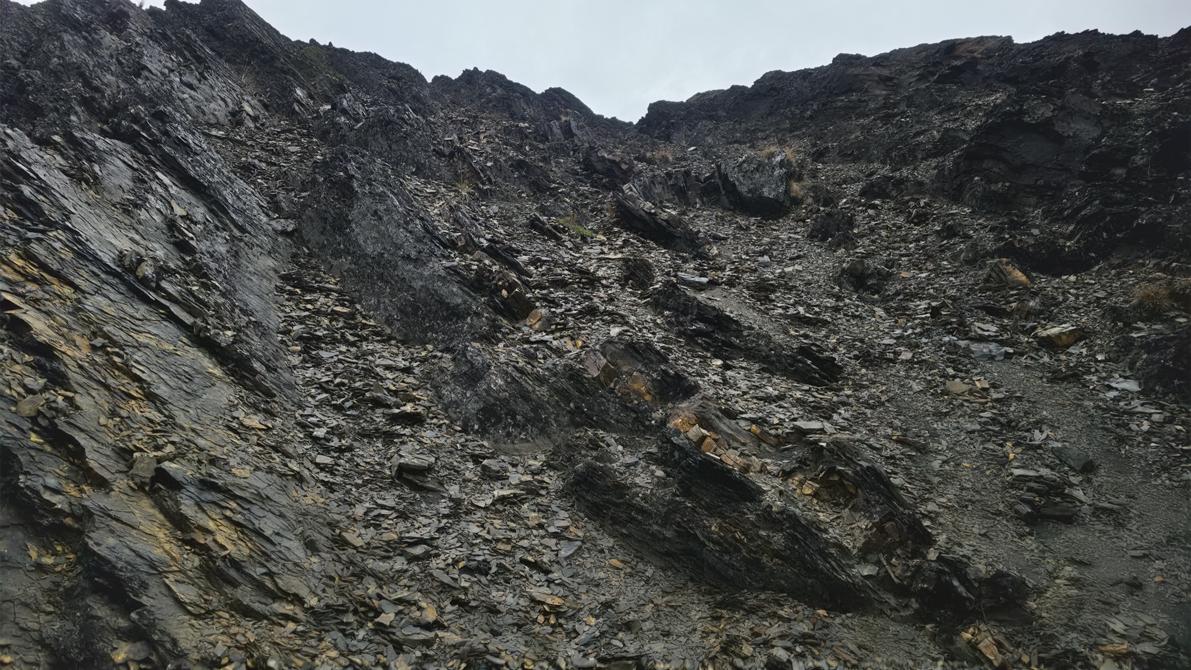
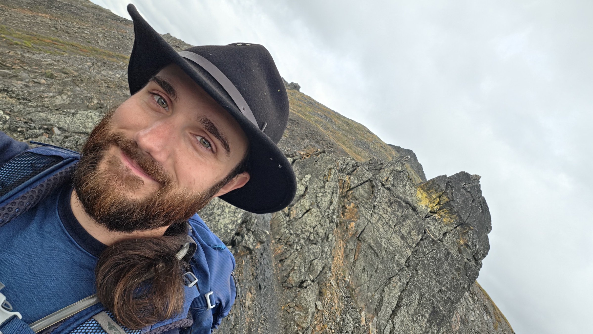
This next ridge had a pleasant plateau, and upon it were heather-like shrubs and large pads of white-ish yellow lichen, presenting me with my first real opportunity to sit down. Eating a quick mix of dried apricots and an assortment of nuts, I was able to photograph the surrounding region and examine the map for any hidden topographic features that may cause me to expend more energy than was necessary. What caught my eye, however, was the time. It was now 6pm and I'd set out just before 3pm. It might only take me an hour from here to return to the truck, the descent being after all much easier than the ascent, but the light of day was beginning to show its first signs of waning. Worse still was the ever looming threat of rain, which had up until that point only sprinkled gently upon me. This wasn't the only element of weather that threatened me, though, as the wind had steadily grown stronger from the point of the spires and I could no longer shelter among their narrow channels or behind boulders. This plateau presented some comforts, but windbreak was not one of them.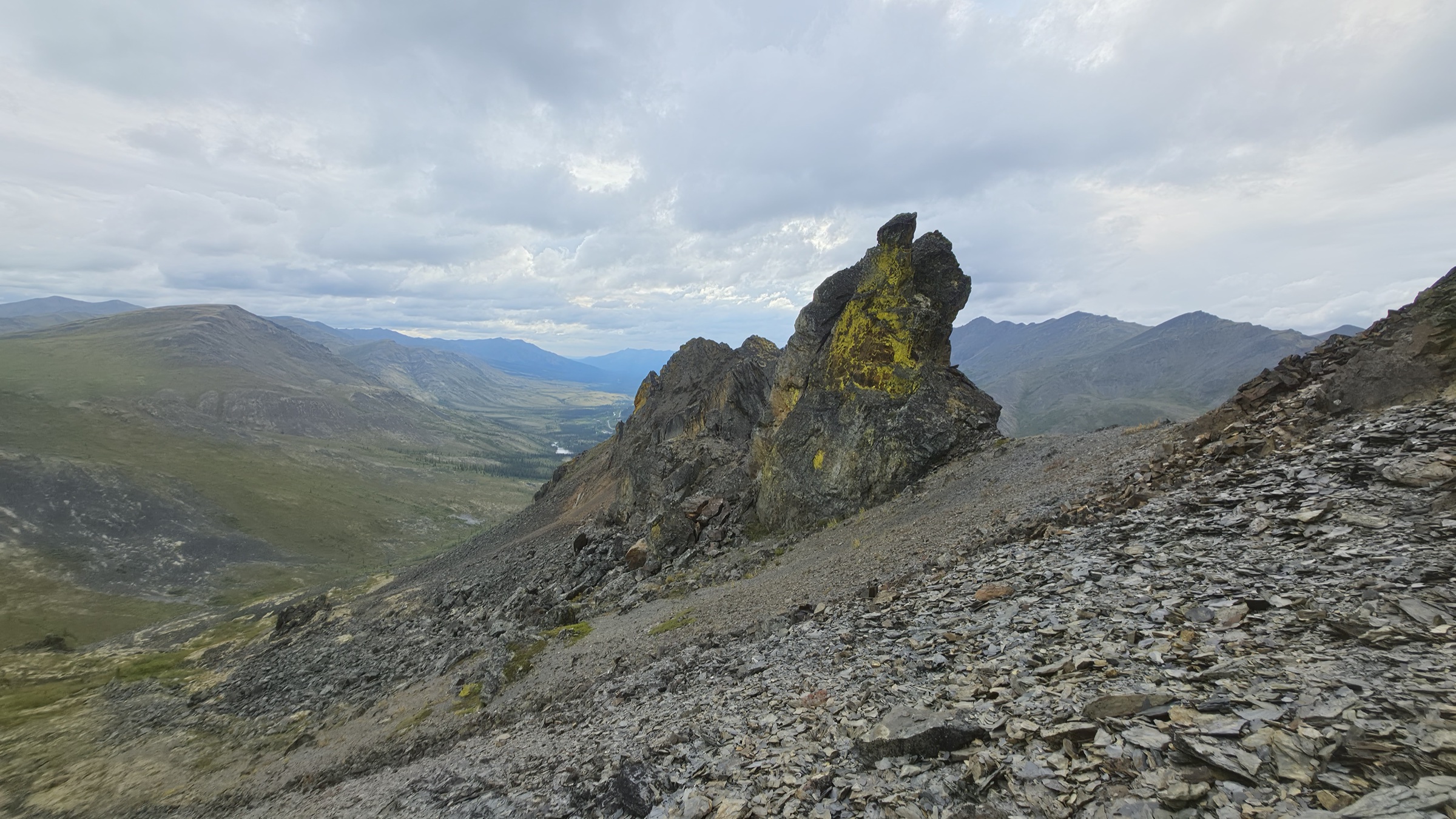
I'd studied the weather, and even down by my truck it was only about 12°C. By now I could feel it was down to 8°C air temperature, perhaps 6°C with windchill. Thanks to my careful study of the map and the forecast, I'd packed a scarf, a toque, a wool long sleeve, and a windbreaker, though I've only ever employed those items during winter, save for the second wool long sleeve layer which had never in all my years been worn during a hike. I was already wearing a single layer merino Smartwool long sleeve, which in winter might have been accompanied by the thinnest class of insulated coats, my Kühl quarter puffer, but never had I needed a second wool long sleeve. Even my Patagonia hiking pants, which have buttons near the calf so you can roll them up into long shorts on a hot day, stayed down all afternoon, which is probably as close as I've come to never using the feature at all, and this would be the last hike where I'd have any use for it anyway. I run hot, and admittedly I expire a lot of sweat when I exert myself, and have since I was very young, so wind exposure normally matters more in these instances than insulation, and wind exposure still requires ventilation lest I die of sweat between myself and my layers. But this hike and this wind presented an anomaly, one that would continue in my arctic hikes this summer as the weather failed to do anything but mock me for all my efforts of getting here.
It wasn't without reward, however, because by now I was able to look north and admire both Mount Goldensides and Black Cap Mountain, each with their distinct colours and features that were expectedly diminished with the current light level. To my south and east I could truly admire the entire ridge that formed between Outrider Mountain and its gradual re-ascent after the prominent drop, leading back up to Mount Big Alex, where my ridge also met, but far more spectacularly thanks to Mount Robert Henderson. Mount Big Alex formed a huge cirque, a bowl formation that connected both ridges, and it was clearly very steep down from the top of the bowl into its bottom where the vegetation returned and specks of snow remained even in late August. The bowl also features some interesting mounds that sit prominently without much vegetation on them, clearly without much soil, and they add a fascinating contrast to the scene. Closer to me I could see a huge talus pile, and it's actually in the foreground of some of my lower elevation photos, that's how tall it is, and even then the scale is hard to describe. I doubt a single man made aggregate pile reaches this large in volume, and it shows how impressive the geological history of the region is.
There's something that happens during a hike, on the way up, at every break in the ridge where the view opens further than it did the last time, and I've never found a good word for it. Elation is close, though it's got nothing to do with the exercise, whatever the endorphin advocates would like you to believe, since I've never once felt it in a gym. You set out to stand somewhere most people will never see, let alone stand on, and you did it for yourself before you did it for anybody you might tell about it later, and the doing turns out to matter less than the not stopping. That feeling lasts days, sometimes weeks, and you're still telling people about it years later, still a slightly larger person than the one who started up the hill.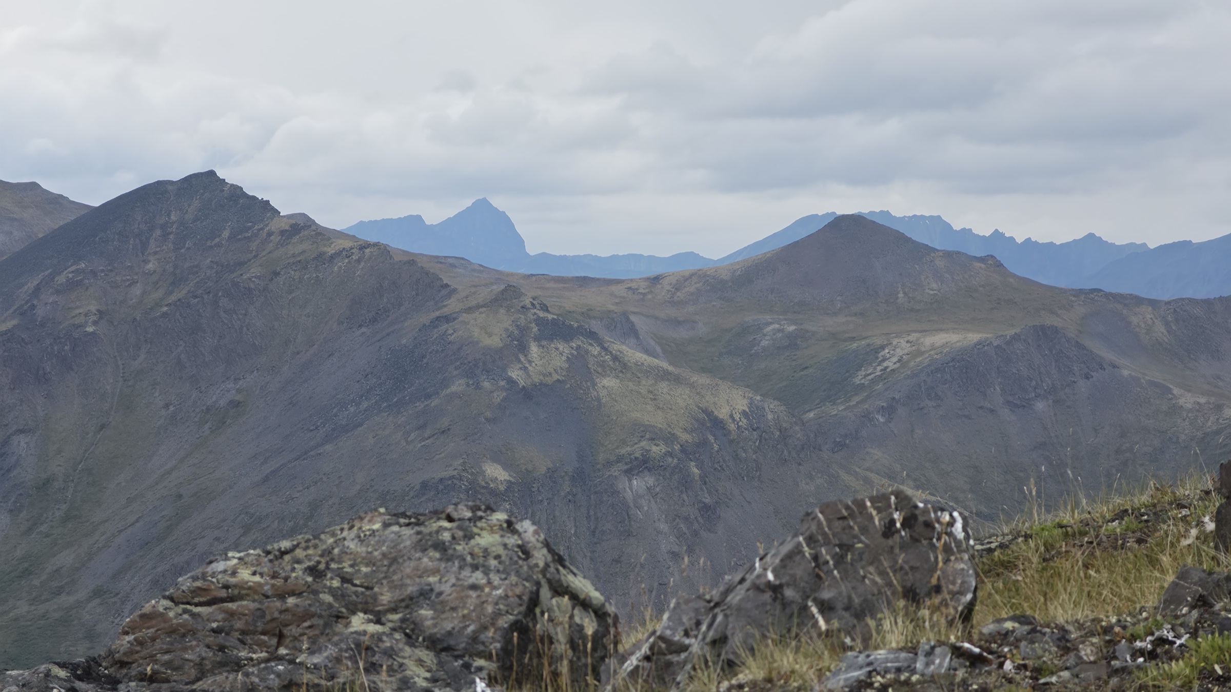
The Summit, and a Mountain in the Distance
Finally, not long after 7pm, I made it to the first actual summit. It wasn't very impressive, as the view was too limited by the weather, or else too similar to what the ridge had already spent an hour giving me. Sometimes the destination really doesn't matter as much as the journey, but every destination holds something, and what this one held was distance.
Sitting down with the map to work out what I was looking at, I learned that the ridge I'd spent the whole afternoon on has a name, and that the name is Discovery Ridge, which I'd either forgotten or never known, and which I discovered while standing on it. How apropos, and how fortunate we are to have such good maps in the world. Not every ridge has a name, mind you, and certainly not every summit, which is something I lose myself contemplating rather more often than is probably useful.
The elevation gain was just enough to make out what I believed to be Mount Monolith in the far distance past Fold Mountain, with its true summit sitting directly behind, and closer in behind Fold was Rockcandy Mountain, a summit I'm eager to reach later this trip. Monolith has a bit of a skyline and quite frankly deserves to be multiple mountains, but as the roots are all syenitic and granitic igneous rock from magma that only just barely reached the surface long, long ago, and then all the sedimentary earth around it eroded away to leave this cathedral of strong rock standing, it's only understandable that the truth is far more respectable than what our ape eyes would demand of us superficially.
My last trip to this park had brought me to Monolith, by the Grizzly Lake trail, the Glissade Pass, and finally Divide Lake, all in a single day. Now, don't tell the park operators this, because it's rather frowned upon and technically the booking system doesn't permit such a hike in the first place. The intention is for it to be a four day, three night trip: make your way to the designated tenting pads at Grizzly Lake, traverse Glissade Pass, stay at the designated tenting pads at Divide Lake, perhaps carry on the following day to the designated tenting pads at Talus Lake to see Mount Tombstone proper, and either way spend another night at Grizzly Lake before returning home. Well, wouldn't you know it, I hadn't the time for such nonsense and decided to complete the hike in two days and one night, paying for an extra couple of nights in parking to make up for the unbooked tenting pads.
To my surprise, other hikers from as far as Utah and Saskatchewan told me that they wouldn't be sleeping a third night at Grizzly Lake either, and that technically, although the system reserves those pads for you, you aren't forced to pay for them. Perhaps this is my misunderstanding, but clearly the park's website was slightly lenient, if only at the cost of everyone who then couldn't book Grizzly Lake for their first night. Either way, I think the operators know that this landscape is already too popular for its own good, and they've made little effort to increase capacity as a result.
Thinking back on the hike proper, I can recall that it was then the most difficult hike of my life, with Glissade Pass marking the most technically challenging summer traverse I'd ever completed. The Grizzly Lake side was almost entirely made up of rock and grassy tufts, which aided greatly in ascending, but which later proved truly awful to the knees on the way down. The Divide Lake side was the steepest talus and scree slope I'd ever been on, a jet fast and high risk action movie genre scree ski that got me to the bottom in under half an hour, and I remember thinking at the time that I'd pay for it in the morning, which turned out to be the only accurate prediction I made that weekend.
What I'd paid for was Divide Lake, surrounded by waist height brush of beautiful small round green leaves, with Monolith towering over my camp in the valley, dark and smooth and impossibly prominent, a true cliff face and a vertical drop competing with only a handful of mountains like it in the world. Morning and evening sun cast bright orange light across it, and the lake reflected the whole thing back in the calm light of either end of the day. It was a sight that, despite all the troubles, washed them away and brought me near to tears, perhaps because of how badly my legs and back hurt by then, though I prefer to think of them as joyous.
Returning over the pass the following morning was agony, and it was terrifying, because there was so little to hold onto beyond massive rock mounds that bulged out from the scree slope. These were of little comfort either, since if you didn't hold onto them you wouldn't remain on them, being simply too jagged and sheer to sit upon. Pushing myself to go from one to the next invoked real terror in me, as my progress could and eventually would backtrack with the awful feeling of not merely gliding down but spending all of my energy avoiding what was so soon to be toppling backwards. Think of Westley and Princess Buttercup rolling comically down that steep grassy hill in The Princess Bride, then increase the slope's incline and replace the grass with a deep layer of sharp and assorted rock sizes up to baseball size, and you'll realize what I mean by terror. It would be less "as you wish" and more "dear lord, I wish for anything else". Reaching each outcrop was both blessing and curse, and I was shaking from head to foot from exertion and fear both, cortisol running through me like acid in my blood. Surely one of the very best views of my life had been worth it, right?
Hours later, after descending to the impressive wall that surrounds Grizzly Lake for lunch and re-ascending the ridge to pass by Rockcandy Mountain and head back down to the forest trail across from Mount Cairns, a young black bear ran up a tree in front of me. Had the day not come pre-installed with enough fear, anxiety, and exhaustion? I gave it a wide berth, having witnessed them leap from trees before, and by the time I reached the SUV I could hardly stand any longer. But unlike that trip, the end of this day would be in style. I'd do very well with the comforts of home, and I wouldn't have the fear of death instilled so deeply into me. So regardless of the weather, standing there appraising the far off summits of yesteryear, I felt fortunate.
Turning Back
I gave it fifteen minutes, which wasn't to deliberate about my route through the terrain, or the light, or the grizzlies, all of which I'd already priced in and none of which frightened me the way the spires had. I was standing on a summit I'd actually reached, looking along the ridge as it ran on toward Mount Robert Henderson and then Mount Big Alex, which from that vantage point looked entirely and tantalizingly walkable, and appraising how long I had left, but I already knew the answer.
The answer was that I'd told my mother I'd be back by 10pm. In exchange for a lighter pack I'd bought myself a hard deadline and 900 metres of descent on the same legs that had just done 900 metres of ascent, when if I had tented I'd have slept somewhere further along Discovery Ridge, made Mount Robert Henderson in the morning on rested legs, and had the whole thing in the bag. The darkness and the coming grizzlies held very little power over me by then, though. What I couldn't stomach was the thought of my mother sitting by a phone at 11pm working out who to call.
As I returned, and fatigue set in, and the cold drew to the wetness that was no longer glistening sweat but soft dew from the sprinkling rain, I began to feel a new resolve and a new daunting sense of dread as I descended the mountain. All those spires and all those boulders were about to prove much harder, not because the light was ever so slightly dim, for it wouldn't truly disappear beyond the horizon until after midnight, but because the rain would undoubtedly cause all surfaces to become slipperier. The run off would perhaps cause loose sediment to stick, but it might also catalyze larger swaths to come down together as surface layer disturbances. When sediment is unevenly wet, it also unevenly clings together, sometimes causing top layers to peel off as if the deeper layers were frozen. A bit like active layer detachments, the history of which I could see on the far away slopes of neighbouring mountains, where active layers, meaning the non-frozen soils, have been in landslides as permafrost thaws unevenly and at differing depths, causing the structured soils to become less structured and also heavier. Or something of that sort, ask your local surficial geologist for clarification, I only had a day with one here in the park at the interpretive centre.
As I descended the large talus plateau, I glimpsed my truck over the sheer cliff. I rejoiced and cursed at this, because it meant there was a chance I could connect to my Starlink dish and communicate my return. Why had I avoided the left side this whole time? Obviously for safety, but as a result I had remained ignorant to the fact that the hill blocking my truck from line of sight while initially ascending the mountain had by now no longer been between me and the truck. To my surprise, I could in fact reach the truck, and after a few moments delay successfully sent an RCS text message to my family indicating my position and trajectory, with an ETA back to the truck. After confirming receipt of this, I continued on my way, cursing that I could have continued my hike for an hour longer with the current light levels and returned to the truck before darkness had fallen around midnight. However, I didn't yet realize that the descent would prove just as difficult as the ascent, would take longer than the hour or two I estimated, and would cause my knees tremendous pain, almost forcing me to take long expired acetaminophen still hanging out in my hiking first aid kit.
But before that realization came, I was face to face with the first spire and only dimly aware of what could have possibly persuaded me to traverse this brutal terrain. As I managed to skirt past it much lower than before, I examined the scree and noticed that it went an awful long way down. There are advantages to this, mainly what I like to call scree skiing as described earlier in my reminiscing of Glissade Pass, and it can be safe so long as the particle size of the scree isn't too large and lacks "erratic" (random) large particles, meaning baseball sized rocks or larger. If there's a high number of those larger rocks, you never know when one will be disturbed and follow in your ski tracks, eventually leading to a high speed collision. Regardless of whether you mess up that rock and it bursts into a thousand pieces, your ankle will suffer a much more meaningful shattering, and so weighing your risks, especially when alone, is pretty critical.
I chose the traverse, and I chose to take it on lower than I had before, because surely any descent was good descent and would save me large boulders to contend with later, right? That may have been true until, after a rather death defying traverse that left me winded, dirty, bruised, and with a pounding heart, I attempted to clamber around the second spire. Taking a moment to collect myself, I hadn't spent much time evaluating the spire during the traverse, and upon inspecting it now I was feeling rather snubbed by the awkwardness of where I'd ended up. Sandwiched between a pile of car-sized boulders, I had no ability to go up, down, or in fact around them without serious risk to my personal safety. A further ten minutes passed while I attempted to clamber up and over, only to find a drop of about 4 metres and a terrible landing, then around, when I nearly slipped and fell a further 12 metres, then two minutes regaining my breath and noticing that a lot of time was being wasted and I'd have to return to the scree no matter what.
Fortunately, I could see that further down the scree was a fine silt, and at the beginning of the traverse was entirely made up of large thin pieces that crushed easily and posed no threat of colliding heavily upon me should I descend. But backtracking would waste precious time, and the nearby scree was a mix of ultra fine sand-like particles and baseball to baseball glove sized rocks. It was a rather ginger affair getting past this last section, which was the closest section to me and where I remained cornered. It was also the steepest component with only a minimal scree layer, which can be to your disadvantage as it fails to create piles or pads as you step, which means instead you get a slick incline with no holds for your feet, at least not until you bump these large rocks which then dislodge and join you in the descent, threatening to hang back and then speed up and collide with you, or worse, sandwich your ankle against a rock further down that isn't moving.
I decided to traverse about half way and try my luck, which to my fortune actually worked out well for me and enabled me to descend about 200 metres in only a few minutes. A remarkable amount of elevation loss with minimal exertion beyond the coordination needed, and I was rather grateful given I had another 550 metres to descend. The only consequence by the end of this was that my boots were full of pebbles and shale fragments and fine dust, but they'd already accumulated a lot of organic matter from the original bushwhacking, so between that and the numbness from the pounding of my feet all afternoon and evening, I hardly noticed until I returned to the truck.
However, at the bottom of this very tall pile of shale dust and sheets, I realized I'd traded one obstacle for another. Because instead of perilous spires to clamber around at great heights, I now had a far longer march across the uneven, shifting, tilting, slippery boulders to make. The continuous crossing of which, seemed to take ages, especially compared to the scree skiing I'd just accomplished, and I was making no real descent anymore. I had to follow this plateau all the way around the mountain back to the ridge for kilometres. Finally, when I met back up with the ridge, I could see the first, or last in the direction of a descent, spiky spire of dark black rock. Partly wishing I'd taken on this tower and the other two I skipped, I looked back at the ridge below me and carried on.
Now that I was descending, more force was being applied to each wide and now tall step down onto the awkward angular boulders, hardly any of which have nice flat surfaces to step onto. Rather than walking down tall steps, it was more like walking down a pile of lego, only rounder and a thousand times larger brick sizes. As I near constantly slipped and teetered on the edge of falling, my back muscles would tighten and contract and cause me gradually more soreness. Every teetering boulder bought a correction from somewhere, and after a couple of kilometres of them it was all coming out of the same two bands of muscle either side of my spine, which had apparently decided the safest posture was to stay braced against a fall that hadn't happened yet. The flailing of my arms, in that entirely inelegant form of angular momentum balance correction, would keep me steady as much as my reptile brain stem could manage. But every so often a boulder would ominously tip and threaten to throw me off, with poor options for recovery given the brutal, angular, steep, and slippery terrain.
By the second kilometre of boulders my right knee had stopped being sore which was ill-news, because soreness you can walk through and largely ignore. This was bright and specific, arriving on every long step down and hanging around a moment after landing with sparks in my eyes and the feeling of knives, and so the knee began stiffening in what I assume was an attempt to protect itself and which only made the next step worse. Compensating offered little to no relief, my left knee was far and above better, but you couldn't compensate easily in terrain like this. I wouldn't say I was close to tears, and I'd rather be accurate than dramatic about it, but I was rationing morale by then the way you ration water, and what I spent it on was a hot shower, a hot meal, and a clean bed, in that order, held in my head with real intensity for something like two hours. Turning back had been for my mother. Getting down was for the shower.
It was no wonder that by the time I'd reached vegetation I was nearly overjoyed into song. If only I'd had the stamina and morale to sing, with only aphids to hear me now that I'd returned to the aromatic bushes that carried them by the dozens. It wasn't just the reduction in peril and the end in sight that brought me joy, however, as my knees were so inflamed and pained that I was nearly falling over as my right knee stiffened in response to the pain jolting through it. These boulders had cost me something, and with each longer step and unsteady recovery I'd put a lot of pressure on them to support me, with little choice but to take my time and thus strain them further. But now, back to the loamy piles, pads, and mounds, my knees were troubled sufficiently less so as to permit me, if not a terribly pained travel, then a grunting, lumbering, trudging past the bushes and across the fields.
Fortunately, as I'd been descending the ridge, I'd spent many minutes in waiting for my knees to ease studying the forest and vegetation down below, plotting precisely the correct path to encounter the least dwarf willows, bushes, and shrubs. It was nearly impossible to tell the heights of many plants, as from high elevation they were miniscule and shared a distinctly similar colour to the over colonized and mixed ground laying vegetation, but I had a fairly good idea thanks to the dark green of the dwarf spruces. The wrench that got thrown in came in the form of two creek crossings I'd inadvertently avoided before. As I'd gone far and around, that also meant I'd gone much closer to the source of these creeks where they were just streams. Thankfully, the rain hadn't been coming down hard or even all day, and so despite some mud I managed to step between two old bushes where they converged to meet their roots on the ground, and evaded most of the wet mucky carnage.
Returning to the safety, warmth, and comfort of the truck was so incredibly welcome. Taking a hot shower and enjoying a hot meal after decompressing is unlike anything I could have hoped for on previous trips to the Tombstones. It's a complete game changer and has really been my year long vision ahead of this four month trip. It's honestly even sweeter given the rainy, cold, unforgiving weather. Who would want to tent for days out here without a shower or heat source or a bed while attempting to hike and sleep through rainy days? Having a sink and a fridge and incredible solar and battery capacity makes this far and above my best trip to the Tombstones overall, despite the difficulties faced on hikes like this one. The last time this park had me limping back to a vehicle, all I got at the end of it was the vehicle.
I said at the outset that I meant to answer this park properly, a month of it, every named mountain I could reach and every ridge on the road side of the river. Sitting in the truck that night with my knees up and the kettle on, I revised that a little. I won't be hiking to Mount Big Alex, and I won't be going back for the Hendersons. I may still do Outrider, though it's not nearly as efficient to reach and it's fairly prominent despite being much shorter, and it wouldn't offer much more of a view than I've already had. What answering properly seems to mean in practice is having enough time here to be turned back off a ridge at 7pm and not have that be the end of anything, which is a luxury I've never once had in this park before.
Not every hike needs to give you the views of Triple Peak or the Matterhorn or Mount Logan. Sometimes the evidence of past geological and glaciological events, mixed with a few hours of having to talk yourself past your own nerves, is enough. I never did find a single boot print on Discovery Ridge, not on the way up and not on the way down, which is worth rather more to me than a mountain everybody has heard of. There are four or five ridges left on my list and roughly three weeks to walk them, and the forecast has not improved.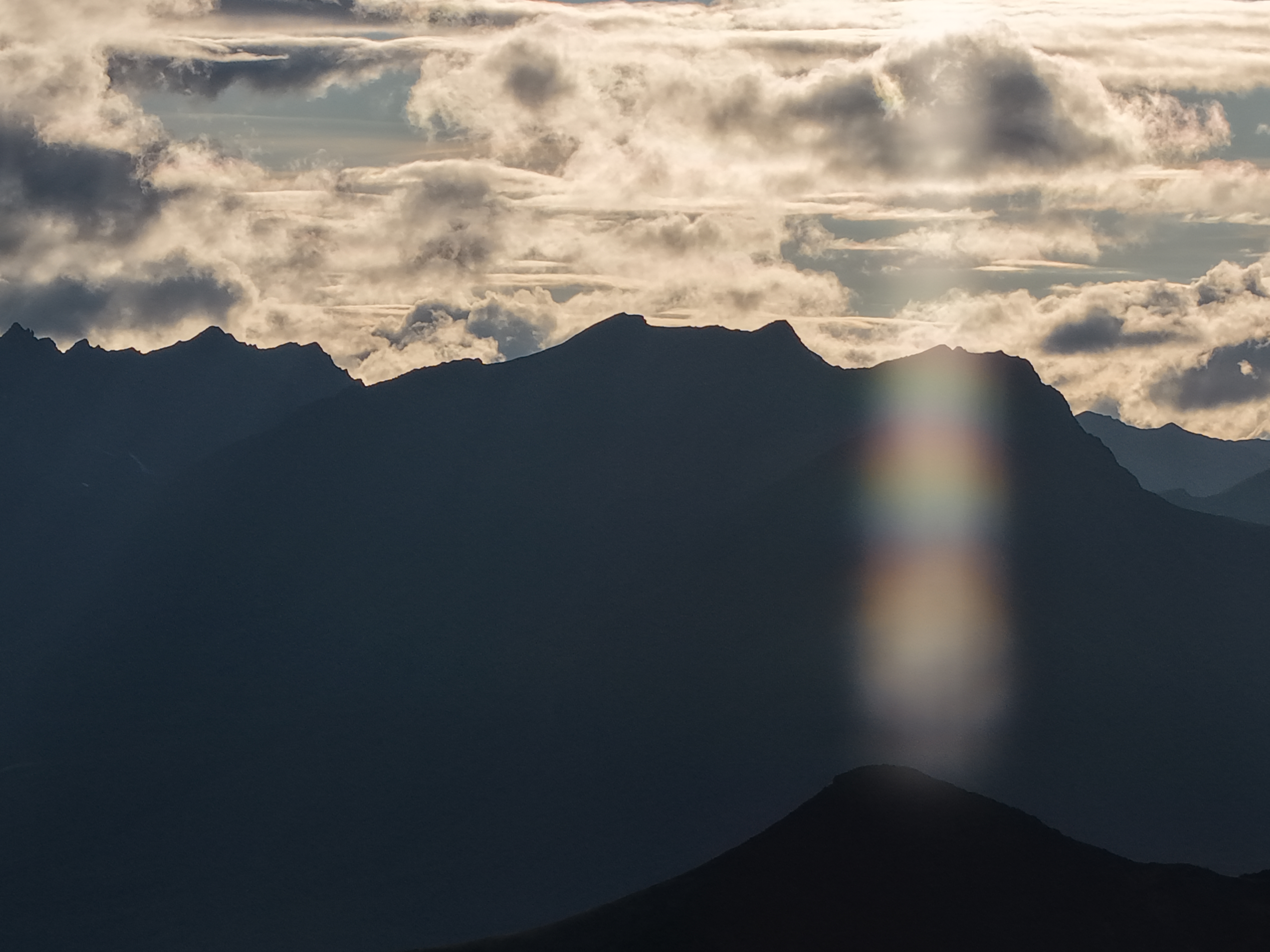
All photos are CC BY-SA by Triston Line.